The Guyana Defence Force Coast Guard did not receive coordinates from an aircraft that sighted a flare during the search for MV Barima survivors, and did not have recorded positions for all locations where survivors and bodies were recovered, its commander told the Commission of Inquiry.
Commander David Shamsudeen also testified that the Coast Guard had no direct contact with aerial operations, had not updated its search-and-rescue procedures during his three years in command, and did not conduct the 24-hour post-operation debrief required by those procedures.
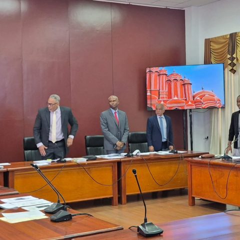
His evidence came as the commission, sitting at the Arthur Chung Conference Centre, examined the coordination and preparedness of agencies responding to the vessel’s July 18 sinking.
Asked whether he or his officers received coordinates for a flare reportedly sighted by a civilian aircraft, Shamsudeen said they had not. He subsequently confirmed that the Coast Guard had no direct contact with aerial operations.
A commissioner questioned whether the information could have helped vessels narrow their search.
Shamsudeen said aerial operations were coordinated through the Maritime Rescue Coordination Centre (MRCC), while the Coast Guard focused on vessels at sea. He identified retired Coast Guard Captain John Flores as heading the centre, which coordinated the overall maritime response.
The commander also acknowledged gaps in the recording of recovery locations.
“We don’t have coordinates for where all of the survivors or deceased were recovered,” he said.
Records documenting persons brought ashore were maintained at a forward operating base, he explained. Survivors and bodies were recovered from several areas, and he undertook to provide further details.
Shamsudeen said the search area was divided into one main sector and approximately six subsectors. Coast Guard vessels were assigned smaller areas and generally searched in a south-easterly direction, guided by local knowledge of tides and currents.
Asked whether records showed the precise boundaries of those subsectors, he said he would have to return to the commission with that information. He also said he received no feedback on the findings of a drone team deployed during the operation.
Shamsudeen explained that he used Google Earth, electronic charts and vessel-monitoring systems to assess distress positions and determine which assets to deploy.
Six distress coordinates received from Timehri Control Tower were plotted on Google Earth to examine their distance from the coastline and proximity to the wreck.
The first vessel was dispatched from the Pomeroon floating base because it was the closest available asset to the general area indicated, he said.
However, a commissioner questioned discrepancies between coordinates shown in the Google Earth presentation and those entered in the Coast Guard’s log.
Shamsudeen said the log reflected the coordinates received from Timehri Tower, but the discrepancy in the displayed chart would have to be examined.
He testified that the first Coast Guard vessel arrived in the area before 2 am on July 19. A flare sighted from a life raft helped guide its crew towards persons in the water.
Local fishermen also assisted. One fisherman followed oil on the sea surface and located an area where a life jacket had surfaced, he said.
Shamsudeen put the number of survivors rescued during Operation Hawkeye 01-2026 at 69, with 73 bodies recovered. Defence Headquarters assigned the operation its name.
Larger vessels searched farther offshore while smaller craft operated nearer the coast, he said. The MRCC coordinated the wider response, including international assets.
Exercises and procedures
Questioned about preparedness, Shamsudeen said he could not recall when the last joint search-and-rescue exercise involving agencies had been held.
He acknowledged that none had taken place in some time, explaining that there had been no need because Guyana had not experienced a similar incident.
Search-and-rescue training formed part of mandatory Coast Guard courses, he said, while selected officers received more comprehensive overseas training through programmes involving the United States, India, the United Kingdom and other partner countries.
Asked whether there was a programme of regular exercises in 2024, 2025 and 2026, he undertook to provide the information.
The commander confirmed that search-and-rescue standard operating procedures inherited from previous commanding officers had not been updated during his tenure. Coast Guard personnel developed the procedures using the International Convention for the Safety of Life at Sea as a guide, he said.
He also acknowledged that the prescribed 24-hour post-operation debrief was not conducted. Debriefings instead took place during the operation and on the ground while personnel remained engaged in rescue efforts.
Shamsudeen said a comprehensive report covering the operation, challenges and recommendations had been submitted through Defence Headquarters. It addressed the response rather than the cause of the sinking.
Asked to submit it to the commission, he said he would seek guidance from Defence Headquarters, as he did not believe he had authority to release it himself.
The Coast Guard maintained logs and reports, but had no digital tracks or voice recordings of the operation, he testified. Its smaller vessels were not fitted with automatic identification system transponders.







Discussion